

Living Ready in the Mountains: A Descanso Homeowner's Guide to Wildfire Preparedness
Living Ready in the Mountains: A Descanso Homeowner's Guide to Wildfire Preparedness
There is a reason so many of us choose the mountains. The oaks, the quiet, the clean air off the ridgelines, the sense of space you just cannot find down the hill. Living in Descanso and the surrounding communities of Mt. Laguna, Pine Valley, Guatay, Alpine, and Julian is a gift. It also comes with a responsibility that flatland neighborhoods do not share, and that is being ready for wildfire.
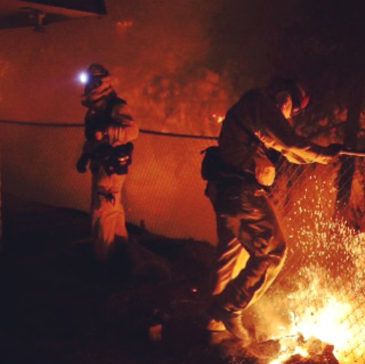
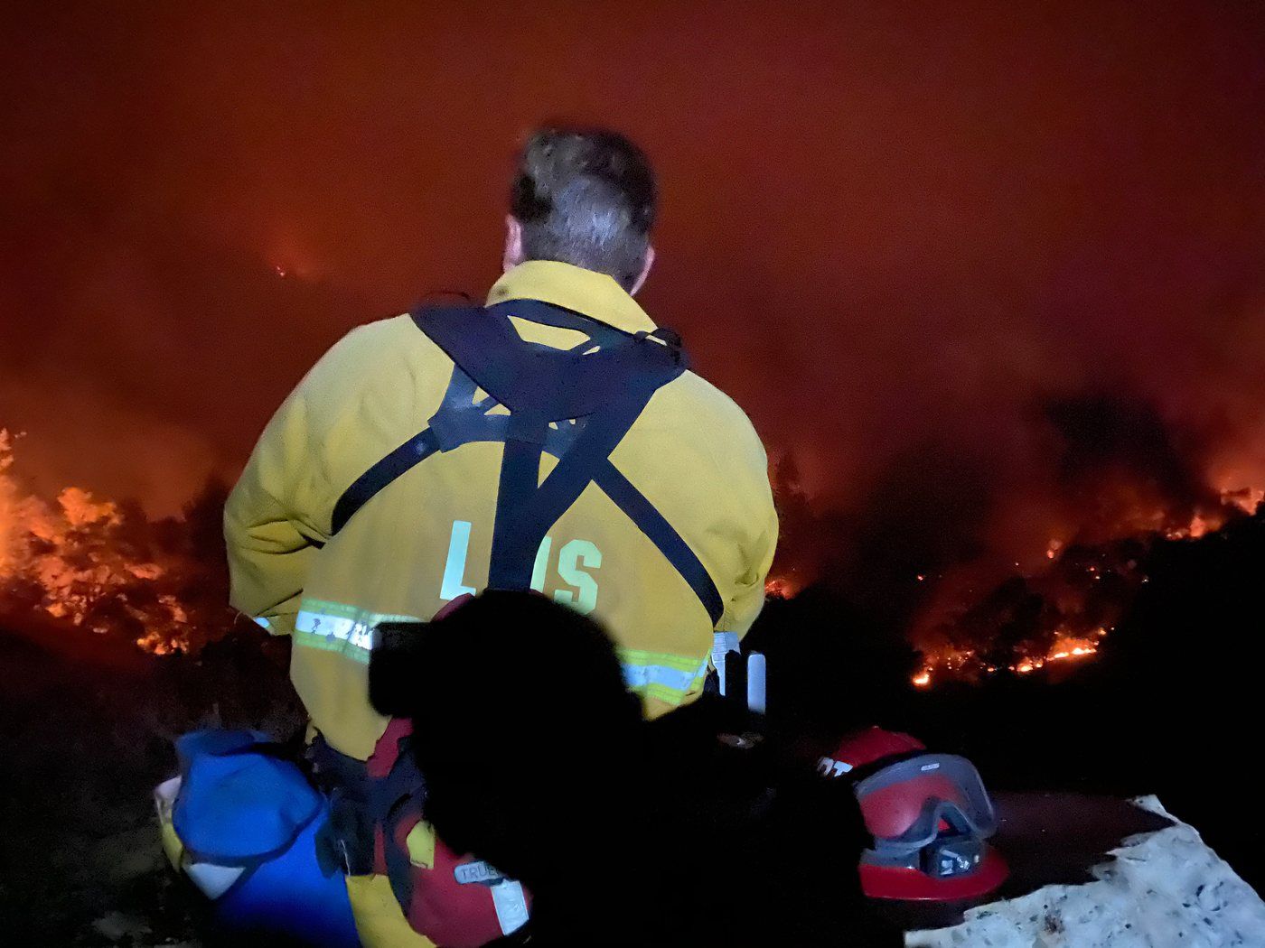
I do not write this as an outsider. I have lived in the Alpine and Descanso community for almost twenty-five years, and I have evacuated from several fires myself. My husband is a fire captain who has worked every major campaign fire in San Diego County since 2000, along with many out-of-county assignments. Fire is part of our family's life, and what follows is the kind of information we genuinely want to share with our neighbors.
This is not a reason to worry. It is a reason to prepare. The good news is that the families who do the work ahead of time tend to feel calmer, not more anxious, when fire season and the Santa Ana winds arrive. Below is a practical, locally grounded guide to Descanso CA fire preparedness, built on guidance from CAL FIRE and the U.S. Forest Service, written for homeowners, buyers, and anyone thinking seriously about mountain living.
Why preparedness matters more up here
Our communities sit in what fire agencies call the wildland-urban interface, the place where homes meet open chaparral, oak woodland, and forest. That setting is part of the beauty, and it is also why San Diego mountain community wildfire safety deserves real attention.
A few realities shape life on the mountain. Our terrain is steep and our fuels are dense, so fire can move uphill quickly. Many properties sit on long private drives or two-lane roads, which means access and exit can be limited. Crews may travel a long way to reach us, so response time is naturally longer than in the city. And our weather, especially during wind events, can turn a small start into a fast-moving fire. None of this is meant to alarm you. It simply means a little planning goes a long way.
What makes a high fire weather day
You do not need to be a meteorologist to recognize a dangerous day. The ingredients are usually the same: low humidity, high temperatures, very dry vegetation, and strong wind. When those line up, especially with our offshore Santa Ana winds, fire can spread far faster than people expect.
When forecasters see these conditions coming, the National Weather Service issues a Red Flag Warning. Think of it as a heads-up that the next day or two carry elevated fire risk. On a red flag day, it is worth keeping your phone charged, your vehicle fueled, and your plan fresh in your mind. CAL FIRE and local agencies often pre-position equipment on these days for the same reason you should stay alert.
"Contained" does not mean "out"
During an active fire you will hear updates about containment percentages, and the language confuses a lot of people. Here is the plain version.
Containment measures how much of a fire's edge has a control line around it, meaning a break in the fuel that firefighters expect will hold. If a fire is fifty percent contained, crews have a secured line around half of its perimeter. It does not mean half the fire is gone.
A fire is called controlled once it has been put out along the inside of those lines and the hot spots have cooled. It is only considered out when there is no smoke and no fire activity left at all. So a fire can be one hundred percent contained and still be burning inside the lines. Knowing this helps you read the news calmly and avoid returning home too soon.
Prepare before there is ever a fire
The work that protects you most happens on an ordinary, quiet day. Sign yourself up for AlertSanDiego and download the SD Emergency app, the county's official notification tools, so warnings reach your phone. Add a couple of apps that our local fire community leans on too. Watch Duty is run by reporters and off-duty firefighters and gives you fast, plain-language updates and maps during an active fire. PulsePoint lets you follow your local fire agencies and see incidents as they are dispatched. You can also follow live conditions through the AlertCalifornia camera network and call 2-1-1 for local emergency information.
Build your go bag now and keep it by the door. CAL FIRE recommends packing a three-day supply of food and water, prescriptions and medical items, copies of important documents, a flashlight and battery radio, phone chargers, cash, a change of clothing including a long-sleeved shirt and long pants, and an N95 mask. Keep a sturdy pair of shoes and a flashlight by your bed, since fires and evacuations often happen at night.
Talk through the plan with everyone in the household. Decide where you will meet, who grabs what, and where you will go.
Evacuation: leave early, and leave on your own terms
Of everything in this guide, this is the part fire officials stress the most. Do not wait.
You will hear two kinds of messages. An Evacuation Warning means there is a potential threat and you should be ready to go, and you should leave now if you need extra time or have animals. An Evacuation Order means the threat to life is immediate and you need to leave right away. If you ever feel unsafe before either one is issued, you are always allowed to go early. Leaving ahead of the crowd means open roads instead of gridlock, which is exactly what you want on a narrow mountain highway.
When it is time, close your windows and doors but leave them unlocked for firefighters, bring flammable items like cushions and doormats inside, and back your car into the driveway pointed out. Then go.
Know more than one way out
Evacuation planning for wildfire in the mountains comes down to one idea: never rely on a single road. Our main arteries, Interstate 8, Old Highway 80, Highway 79 toward Julian, and Sunrise Highway up to Mt. Laguna, are familiar to all of us, but any of them can close quickly because of the fire itself, downed lines, or emergency traffic.
Sit down with a real map and trace at least two routes out of your neighborhood in different directions. Walk or drive them so they feel automatic under stress. Mark them in your go bag too, since CAL FIRE suggests carrying a map with at least two routes drawn on it.
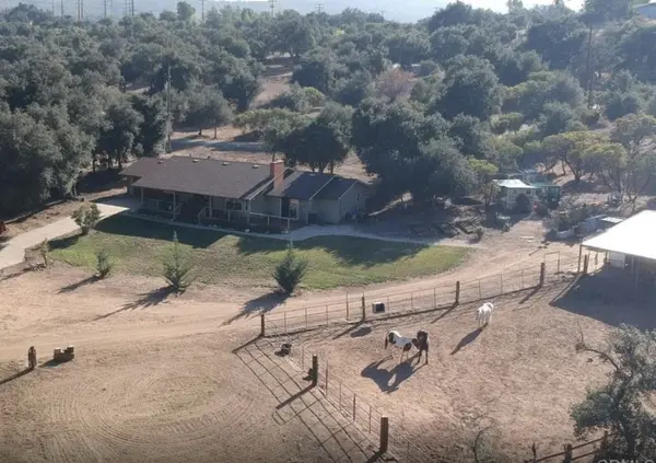
Planning for livestock and large animals
Horses, goats, and other large animals need a head start, and that is exactly why livestock wildfire evacuation has to be planned long before a red flag day.
During a Santa Ana wind event, hook up your trailer and load it with feed, water buckets, and several gallons of water per animal. Practice loading your animals on calm days so the trailer is familiar and they load without panic. Make sure every animal carries identification with your phone number, whether that is a tag, a band, or a livestock crayon marking on the coat. Trade plans with neighbors and identify a place to take animals ahead of time. The San Diego County Department of Animal Services can assist and coordinate large-animal evacuation, and the San Diego Humane Society's Emergency Response Team supports them during declared disasters. The County has opened large-animal shelters during past fires, so know where to call before you need to.
The hardest lesson from past fires is simple: roads may close early, and you will not be allowed back in for your animals. Move them before the order comes.
Home hardening and defensible space
Two things give a mountain home its best chance: how it is built and what surrounds it. This is the heart of mountain home fire safety, and it is also what insurers increasingly want to see.
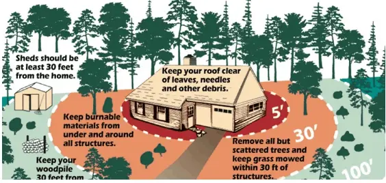
Defensible space in California is organized into zones measured out from your house. The ember-resistant area within five feet of the structure should be kept clear of anything that burns, including mulch, dead plants, and combustible materials right against the walls. From five to thirty feet, keep grass short, space out shrubs and trees, and clear dead vegetation. From thirty to one hundred feet, reduce and space the fuels so fire slows as it approaches. State law (Public Resources Code 4291) requires one hundred feet of defensible space in our area.
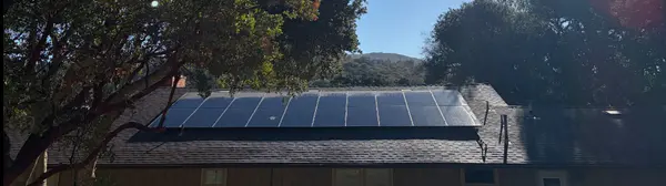
Home hardening targets the small openings where embers get in. Clean leaves and needles from your roof and gutters, screen vents with fine metal mesh, use ember-resistant attic and crawlspace vents, and choose fire-resistant materials when you reroof or rebuild. Most homes that ignite in a wildfire are lost to wind-blown embers, not a wall of flame, so these details matter more than they look.
Your quick checklist
For your family
- Sign up for AlertSanDiego and download the SD Emergency app, Watch Duty, and PulsePoint
- Pack a go bag and keep it by the door, plus shoes and a flashlight by the bed
- Map at least two evacuation routes and practice driving them
- Keep your vehicle fueled to at least half a tank during fire season
- Maintain one hundred feet of defensible space and clear roof and gutters
- Screen vents and address ember entry points around the house
- Agree on a meeting place and an out-of-area contact
For livestock owners
- Keep a working trailer and tow vehicle ready during wind events
- Practice loading your animals on calm days
- Stock feed, water buckets, and several gallons of water per animal
- Put identification with your phone number on every animal
- Arrange a relocation spot and a backup with neighbors in advance
- Save County Animal Services and know where large-animal shelters open
- Evacuate animals early, before any order is issued
A calm word before the next wind event
Preparing for wildfire is not about living in fear. It is about loving where you live enough to protect it, and giving yourself the peace of mind that comes from having a plan. The families who feel steadiest during fire season are the ones who did the small things early: cleared the brush, packed the bag, mapped the routes, and practiced loading the horses on a quiet Saturday.
Pick one item from the checklist this week. Then pick another next week. By the time the hot, dry winds arrive, you will already be ready, and you will be able to focus on what matters most, which is getting your family and animals out safely.
Always follow CAL FIRE, the U.S. Forest Service, and your local emergency alerts and evacuation orders. They have the most current picture of any fire, and your safety comes first.
Jen Kleist is a Realtor with Coldwell Banker West who lives and works in Descanso and serves the mountain communities of San Diego County. If you are buying, selling, or settling into mountain living and want to talk through what fire-smart property looks like, reach out anytime.
Coldwell Banker West | DRE #02228818 | JenKleist@gmail.com
Categories
Recent Posts


GET MORE INFORMATION